 by
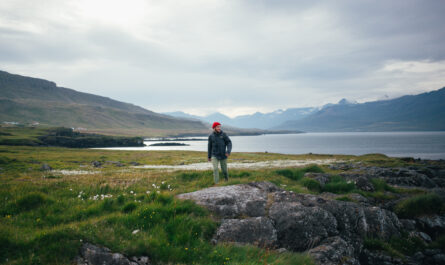
by Few natural landscapes stop people in their tracks quite like fjords. Towering cliffs plunge into deep, glassy waters. Waterfalls spill from hanging valleys. Clouds drift between peaks that look almost sculpted by hand. Found in places like Norway, New Zealand, Chile, Greenland, Canada, and Alaska, fjords are among Earth’s most visually striking features.
But fjords aren’t just beautiful — they are the result of immense geological power acting over tens of thousands of years. Behind their calm surfaces lies a story of crushing ice, relentless erosion, rising seas, and complex earth processes.
Let’s explore the science behind how fjords form — and why they look the way they do.
What Is a Fjord, Scientifically Speaking?
A fjord is a long, narrow, deep sea inlet that is surrounded by mountains or steep cliffs. The defining scientific features include:
- A U-shaped valley
- Formed by glacial erosion
- Later flooded by seawater
- Often extremely deep, sometimes deeper than the adjacent ocean
In simple terms: a fjord is a drowned glacier valley.
But the journey from mountain snow to majestic fjord involves multiple stages that span ice ages and climate shifts.
Stage 1: Snow Accumulation and Glacier Formation
Fjord formation begins in cold climates where snowfall exceeds melting year after year. Over time:
- Snow layers build up.
- Pressure compresses lower layers.
- Air is squeezed out.
- Snow transforms into dense glacial ice.
This mass becomes a glacier — essentially a slow-moving river of ice.
Unlike rivers that flow quickly, glaciers creep downhill under their own weight at speeds ranging from centimeters to meters per day. Though slow, they are incredibly powerful geological agents.
Stage 2: Glaciers Begin to Carve the Landscape
As glaciers move, they reshape the terrain through two key processes:
1. Plucking (Quarrying)
Meltwater seeps into cracks in bedrock, refreezes, and breaks off chunks of rock. The glacier pulls these rocks away as it moves.
2. Abrasion
Embedded rocks and debris act like sandpaper, grinding and polishing the valley floor and walls.
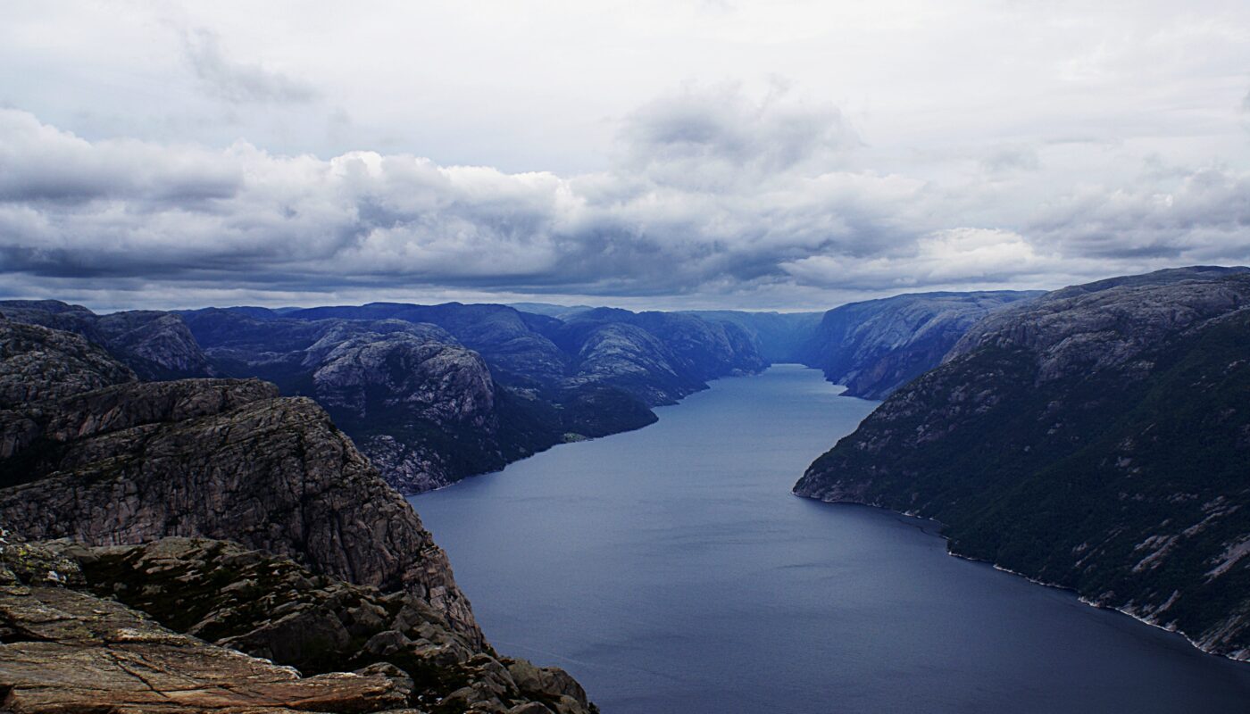
Over thousands of years, this action transforms a V-shaped river valley into a wide, U-shaped trough — the classic signature of glacial erosion.
This is why fjord walls are:
- Steep
- Smooth in places
- Dramatically vertical
The glacier doesn’t just scrape the surface — it deepens the valley far below sea level.
Stage 3: Overdeepening — Why Fjords Are So Deep
Glaciers are thickest in valley centers, so erosion is strongest there. This creates a phenomenon called overdeepening.
As a glacier advances:
- The middle of the valley is carved deeper than the mouth.
- The inner basin becomes extremely deep.
- A shallower threshold forms near where the glacier met the sea.
This explains why fjords often:
- Have deep central basins
- Are shallower at the entrance
- Can be deeper than the ocean beyond
Some fjords reach depths over 1,300 meters (4,265 ft) — deeper than many continental shelves.
Stage 4: The Ice Age Ends — Glaciers Retreat
During the last Ice Age, massive glaciers covered large parts of the Northern Hemisphere. But as the climate warmed:
- Glaciers melted.
- Ice sheets retreated uphill.
- Valley troughs were left behind.
Without the glacier, the carved valley remained — but now it sat below sea level in many places.
Stage 5: The Sea Floods the Valley
As global ice melted, sea levels rose worldwide. Ocean water filled the deep glacial valleys, creating fjords.
This process is called marine transgression — when the sea advances inland due to rising water levels.
The result:
A dramatic coastal inlet with towering rock walls, deep water, and often branching side valleys.
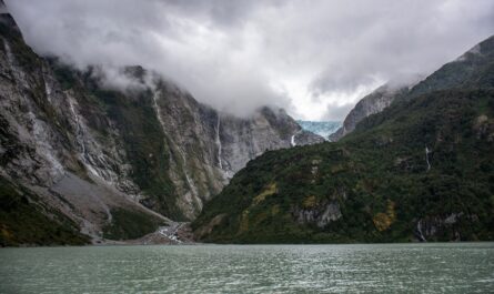
Why Fjords Have Waterfalls and Hanging Valleys
Have you noticed waterfalls plunging straight down fjord walls? That’s another glacial clue.
Main glaciers are larger and more powerful than tributary glaciers. So:
- The main glacier carved a deep valley.
- Smaller side glaciers carved shallower valleys.
- When ice melted, the side valleys were left “hanging” above the main fjord.
Water from these elevated valleys now spills down as waterfalls — sometimes hundreds of meters high.
The Role of Isostatic Rebound
Glaciers are so heavy that they actually press the Earth’s crust downward. When the ice melts:
- The land slowly rises back up.
- This is called isostatic rebound.
In some fjord regions, land is still rising today — thousands of years after the glaciers retreated. This ongoing movement changes coastlines and fjord depths over time.
Why Fjords Have Calm, Layered Water
Fjords often contain layered water systems:
- Surface layer — fresher water from rivers and melting snow.
- Deep layer — salty ocean water trapped below.
Because the fjord entrance may be shallow, deep water doesn’t circulate easily, creating unique marine ecosystems.
This explains why fjords:
- Have rich marine life
- Often appear calm and glassy
- Support cold-water species
Where Fjords Form (And Why Not Everywhere)
Fjords form only where certain conditions align:
✔ High mountains near coast
✔ Heavy glaciation in the past
✔ Strong glacial erosion
✔ Rising sea levels after ice retreat
That’s why fjords are concentrated in:
- Norway
- Alaska
- British Columbia
- Greenland
- Patagonia (Chile)
- New Zealand’s South Island
Places with glaciers but no coastline get U-shaped valleys — not fjords.
Why Fjords Look So Dramatic
Fjords seem almost unreal because multiple extreme processes overlap:
| Feature | Scientific Cause |
|---|---|
| Sheer cliffs | Intense glacial carving |
| Deep water | Overdeepened glacier valleys |
| Waterfalls | Hanging tributary valleys |
| Calm surfaces | Protected from ocean waves |
| Sharp peaks | Resistant bedrock + erosion |
Nature essentially used glaciers as giant carving tools, then filled the result with sea.
Fjords Are Still Changing Today
Fjords are not static. They continue evolving through:
- Landslides
- Sediment buildup
- Glacier melt (where glaciers still exist)
- Rising sea levels from modern climate change
Some fjords even experience tsunamis triggered by rockfalls, showing they remain geologically active landscapes.
A Landscape Written by Ice
Fjords are monuments to ice — proof that slow processes can produce staggering beauty. What feels timeless was shaped by:
- Climate cycles
- Ice movement
- Geological uplift
- Ocean changes
Every cliff face, waterfall, and deep inlet tells a story thousands of years in the making.
Final Thought
When you look at a fjord, you’re seeing the aftermath of a colossal sculpting project by glaciers — the most powerful landscape-shaping force on Earth during the Ice Ages. These dramatic coastlines are where geology, climate, and time meet to create scenes that feel almost mythic.
Understanding how fjords form doesn’t take away their magic — it makes them even more awe-inspiring.