by
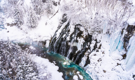
Some of the most spectacular landscapes are the most dramatic landscapes. Imagine a narrow stretch of deep blue water surrounded by towering cliffs, snow-covered mountains, waterfalls, and green valleys. These extraordinary landscapes can be found in Norway, Greenland, Iceland, New Zealand, Canada, Alaska, Chile, and other regions that experienced extensive glaciation.
But fjords raise an interesting geological question: Are fjords still forming today?
The answer is yes, although fjord formation is an extremely slow process when measured against a human lifetime. The glaciers that created many of the world’s famous fjords developed and disappeared through repeated ice ages. However, glaciers are still modifying mountain landscapes today, and the processes responsible for fjord formation have not completely stopped.
Modern glaciers continue to move, erode rock, transport sediment, and reshape valleys. At the same time, rivers, landslides, weathering, sea-level changes, and land uplift continue altering existing fjords.
Understanding modern fjord formation therefore requires looking beyond the simple idea that a glacier moves through a valley and leaves a fjord behind.
What Is a Fjord?
A fjord is a long, narrow body of seawater that extends inland between steep mountain slopes or cliffs. Its characteristic shape is usually the result of glacial erosion followed by flooding by the sea.
Before becoming a fjord, the landscape is generally a mountain valley occupied or repeatedly occupied by a glacier.
Over thousands or millions of years, moving ice can deepen and widen the valley. When the climate warms and the glacier retreats, seawater may enter the lower portion of the valley.
This creates a marine inlet with the characteristic appearance of a fjord.
The basic process can be summarized as:
Mountain valley → glacial erosion → deep U-shaped valley → glacier retreat → seawater enters → fjord
The process sounds simple, but the actual geological history behind a major fjord can be extraordinarily complex.
How Do Glaciers Create Fjords?
The formation of fjords begins with glaciers.
A glacier forms when snow accumulates in a cold environment faster than it disappears. Over time, layers of snow become compressed and transform into dense ice.
When enough ice accumulates on a mountain, gravity causes it to move downhill.
This movement is incredibly powerful.
A large glacier can carry rocks, gravel, sand, and other debris within and beneath the ice. As the glacier travels across the landscape, this material interacts with the underlying rock.
Two processes are particularly important: abrasion and plucking.
Glacial Abrasion
Abrasion occurs when rocks trapped in moving ice scrape against bedrock.
The process is similar to sandpaper moving across a surface, except that glaciers operate on a vastly larger scale.
Over long periods, abrasion can smooth, scratch, polish, and remove bedrock.
As glaciers repeatedly move through a mountain valley, they can significantly deepen and widen it.
Glacial Plucking
Plucking works differently.
Meltwater can enter cracks in the underlying rock. In suitable conditions, water can freeze and help loosen pieces of bedrock.
The moving glacier can then pull these pieces away and transport them downstream.
Together, abrasion and plucking allow glaciers to reshape mountain valleys dramatically.
Why Are Fjord Valleys So Different From River Valleys?
One of the easiest ways to recognize a glacial valley is its shape.
Rivers typically create V-shaped valleys because flowing water concentrates erosion along a relatively narrow channel.
Glaciers behave differently.
Because they occupy a much larger area and exert enormous pressure across the valley floor and sides, they can create broad, steep-sided U-shaped valleys.
When seawater later floods such a valley, the result can become a fjord.
This explains why many fjords have almost vertical cliffs rising directly from the water.
Why Are Some Fjords Extremely Deep?
The remarkable depth of certain fjords is another clue to their glacial history.
Glaciers can erode valleys far below the level that ordinary rivers would typically reach.
The enormous weight of thick ice increases pressure at the glacier’s base, allowing the ice to interact strongly with the underlying landscape.
Repeated glacial advances can deepen an existing valley even further.
When the ice eventually retreats and seawater floods the depression, a very deep marine basin remains.
Some fjords also contain underwater ridges known as sills near their entrances. These shallower areas can influence water circulation and the movement of marine life within the fjord.
Were Today’s Fjords Created by One Ice Age?
Usually not.
Many major fjords have experienced repeated periods of glaciation.
During an ice age, glaciers may advance through an existing valley. During warmer intervals, they may retreat. Later, another cold period can cause glaciers to return.
Each glacial cycle can modify the landscape left behind by earlier glaciers.
This means that many modern fjords are the products of multiple generations of glaciers rather than a single event.
Some valleys have been repeatedly deepened and reshaped over extremely long geological periods.
The fjord visible today may therefore represent only the latest stage in a much older landscape history.
Are Fjords Still Being Carved by Glaciers?
Yes.
Glaciers are still capable of eroding bedrock today.
Modern examples can be observed in parts of Greenland, Antarctica, Alaska, the Canadian Arctic, Patagonia, Iceland, and high mountain regions.
However, there is an important difference between ongoing erosion and rapid fjord creation.
A modern glacier may remove rock from a valley every year, but the amount removed during a human lifetime may be tiny compared with the enormous volume of a major fjord.
Geological landscapes often develop so slowly that their changes become obvious only when measured over decades, centuries, or longer.
Scientists can detect these changes using field measurements, satellite observations, aerial photography, and geological studies.
Greenland: One of the Best Places to Study Modern Fjord Processes
Greenland provides an extraordinary natural laboratory for studying glaciers and fjords.
The Greenland Ice Sheet contains enormous quantities of ice, and many outlet glaciers flow from the interior toward the coast.
Some reach the ocean and become tidewater glaciers.
At their fronts, ice can break away and float into the sea. This process is called calving and produces icebergs.
But calving is only part of the story.
The glacier also transports sediment from the interior toward the coast. Meltwater can carry fine particles into the surrounding fjord, where they settle on the seafloor.
By studying these processes, scientists can learn how modern glaciers interact with marine environments and compare them with evidence preserved in ancient fjord sediments.
Norway’s Fjords Are Still Changing
Norway is famous for its spectacular fjords, including Geirangerfjord, Sognefjord, Hardangerfjord, and Nærøyfjord.
Although these landscapes were largely shaped during past periods of extensive glaciation, they are not geologically frozen in place.
Their surrounding mountains continue to experience:
- Rockfalls
- Landslides
- Weathering
- River erosion
- Sediment movement
- Snow and ice activity
- Coastal processes
Some modern glaciers in Norway continue to modify the terrain, although many have experienced substantial changes in size over recent decades.
This means that the fjords remain active geological environments even where the original glaciers have become much smaller.
Landslides Can Reshape a Fjord in Seconds
Glacial erosion is slow, but other fjord processes can be surprisingly fast.
Fjord walls are often extremely steep. Gravity constantly works on these slopes.
Eventually, weakened sections of rock can collapse.
A large landslide entering a fjord can displace a huge volume of water and potentially produce powerful waves.
This creates a fascinating contrast.
A glacier may require thousands of years to noticeably deepen a valley, while a major landslide can alter part of a fjord almost instantly.
The landscape therefore contains processes operating at completely different speeds.
Sediment Is Constantly Changing Fjord Floors
Glaciers are excellent at transporting sediment.
As ice moves over bedrock, it can grind rock into extremely fine particles known as glacial flour.
Meltwater streams can carry this material into nearby fjords.
Once the water slows down, much of the sediment settles to the bottom.
Over long periods, layers of sediment accumulate.
Rivers also contribute sand, gravel, mud, and organic material.
Consequently, a fjord’s floor is constantly changing.
Some areas may become deeper because of erosion, while other areas become shallower because sediment accumulates.
This interaction between erosion and deposition is one of the reasons fjord environments remain dynamic.
What Happens When a Glacier Retreats?
When a glacier retreats, the landscape it leaves behind begins a new chapter.
Previously covered rock becomes exposed.
Freshly deposited sediment may be visible.
Small streams can develop.
New lakes may form behind deposits or in depressions created by the glacier.
Plants gradually begin colonizing newly exposed land.
Over time, soils develop and ecosystems expand.
In coastal areas, seawater may occupy newly exposed depressions if the local elevation and landscape allow it.
Glacier retreat therefore does not mean the landscape stops changing.
Instead, it shifts from a predominantly ice-dominated environment toward a combination of water, vegetation, sediment, rock, and biological processes.
Can Climate Change Create New Fjords?
This question requires some care.
Climate warming is causing many glaciers to retreat, exposing valleys that were previously covered by ice.
However, glacier retreat does not automatically create a new fjord.
For a newly exposed valley to become a fjord, several conditions would need to be met.
The valley would need an appropriate elevation and connection to the sea. The local bedrock structure, land uplift, sea level, sediment accumulation, and drainage system would all influence what happens next.
Some glacier-carved valleys may remain as freshwater valleys or lakes.
Others may eventually become connected to marine waters.
The important point is that these transformations generally occur over long periods rather than immediately after a glacier retreats.
Could Existing Fjords Eventually Disappear?
Fjords are not necessarily permanent.
Given enough geological time, their appearance can change dramatically.
Sediment carried by rivers and glaciers can accumulate on the seafloor.
Land can rise.
Sea level can change.
Rockfalls can modify the walls.
Weathering can weaken cliffs.
Vegetation can spread across exposed terrain.
In some places, sediment could eventually fill large portions of a fjord.
This may take extremely long periods, but it demonstrates an important geological principle: landscapes are constantly evolving.
How Sea-Level Changes Influence Fjords
Sea level plays a major role in determining whether a glacial valley becomes flooded by seawater.
During major ice ages, huge quantities of water are stored in glaciers and ice sheets. Global sea level falls.
When ice melts, water returns to the ocean and sea level rises.
The relationship between land elevation and sea level can therefore change substantially over geological time.
There is another factor: the land itself can move.
When massive ice loads disappear, Earth’s crust can gradually rise in a process known as glacial isostatic adjustment.
This can alter coastlines and change the depth or extent of marine water within former glacial valleys.
Fjords Preserve Evidence of Ancient Climate
Fjords are valuable to scientists because they preserve evidence of environmental history.
Sediments deposited on the bottom can contain clues about earlier conditions.
Researchers may study sediment layers to investigate:
- Ancient glacier advances
- Glacier retreats
- Past temperatures
- Sea-level changes
- Major floods
- Landslides
- Changes in vegetation
- Sediment supply
In this sense, a fjord can function like a natural history book.
Its walls reveal the effects of erosion, while its sediments preserve evidence of environmental changes that happened long before modern measurements existed.
How Scientists Study Fjord Formation Today
Scientists use a combination of modern technology and traditional geological research to understand fjord formation.
Satellite Imagery
Satellites can reveal changes in glacier area, ice movement, snow cover, lakes, and coastlines.
By comparing images collected years apart, researchers can identify changes that are difficult to notice from the ground.
Field Surveys
Researchers can visit glaciers and fjords to measure ice thickness, movement, sediment, water conditions, and bedrock characteristics.
Seafloor Mapping
Sonar technology can map the underwater shape of fjords.
These maps help scientists identify deep basins, underwater ridges, sediment deposits, and evidence of former glacial movement.
Sediment Cores
Scientists can extract long columns of sediment from fjord floors.
Different layers may contain evidence from different periods in the past.
Together, these methods provide a much clearer picture of how fjords develop.
What Is the Difference Between a Fjord and a Glacial Valley?
A glacial valley is a landform carved by a glacier.
A fjord is essentially a glacially carved valley that has been flooded by the sea.
This distinction is important.
Not every glacier-carved valley is a fjord.
If a valley remains inland and is not flooded by marine water, it may simply be classified as a glacial valley.
If seawater enters the lower portion of the valley, it can become a fjord.
Are Fjords Still Growing Deeper?
In some locations, active glaciers can continue eroding their beds.
However, the rate of erosion varies significantly.
Factors include:
- Glacier thickness
- Ice velocity
- Bedrock type
- Water pressure beneath the glacier
- Amount of debris
- Temperature
- Local topography
A rapidly moving, thick glacier interacting with fractured bedrock may erode differently from a thin, slow-moving glacier over resistant rock.
Therefore, it is not accurate to say that every fjord is currently becoming deeper.
Some are being modified by active glaciers, while others are mainly changing through sedimentation, landslides, weathering, and coastal processes.
Why Fjords Matter for Understanding Climate Change
Modern fjords provide valuable evidence of how landscapes respond to changing climate conditions.
When glaciers retreat, they expose new terrain.
When glaciers advance, they can cover and reshape existing landscapes.
Changes in glacier size can affect sediment delivery, freshwater input, ecosystems, and fjord circulation.
Scientists can compare current observations with geological evidence from earlier periods to understand how glaciers responded to past climate changes.
This makes fjords important not only as scenic destinations but also as natural laboratories for climate and geological research.
What Will Fjords Look Like in the Future?
The appearance of many fjords will continue to change.
In areas where glaciers are retreating, more bedrock and sediment may become exposed.
New lakes may develop.
Vegetation may spread into recently deglaciated areas.
River systems may reorganize.
Sediment may accumulate in fjord basins.
In other areas, glaciers may remain active and continue eroding the landscape.
Future changes will depend on local climate, glacier behavior, sea-level trends, land movement, and geological conditions.
There will not be one universal future for every fjord.
Are Fjords Still Forming Today? The Final Answer
So, are fjords still forming today?
Yes—but the answer needs some context.
The world’s major fjords were largely created through repeated glacial activity over immense periods of geological time. Ancient glaciers carved deep valleys into mountains, and later sea-level conditions allowed seawater to flood many of those valleys.
However, the geological processes responsible for creating and modifying fjords are still active.
Modern glaciers continue to move and erode rock.
Meltwater transports sediment.
Rivers reshape valley floors.
Landslides alter steep mountain walls.
Weathering breaks down exposed rock.
Sea-level changes influence coastal environments.
Land continues to respond to the disappearance of ancient ice.
What we see today is therefore not a finished geological product.
It is a snapshot in a constantly changing landscape.
A fjord may look permanent to a traveler standing beside it, but geological time tells a different story. The cliffs, water, sediments, glaciers, and surrounding mountains are all participating in processes that will continue long after today’s landscapes have changed.
For visitors, this makes fjords even more fascinating. A dramatic Norwegian fjord is not simply a beautiful remnant of the Ice Age. It is part of an ongoing interaction between ice, water, rock, climate, and gravity.
The next time you look across a fjord, you are looking at the result of an extraordinary geological journey—and that journey is still continuing.